
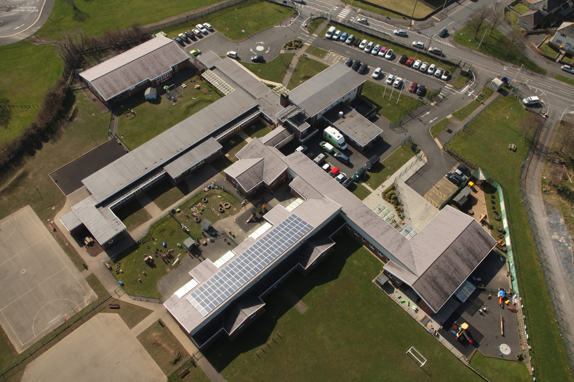
Let's study an aerial photograph and a plan of the school grounds!Could you find your way around?
(e.g. forward, back, left, right)
(e.g. North, North West, South, East, West)
(e.g. picture taken from the sky 'google maps')
The appearance of an object or place from above.
The main tool used by geographers. Maps show features in a plan view as birds see it from above.
A symbol is a picture on the map that represents something in the real world.
A small picture of each of the symbols used on the map, along with a written description of the meaning of each of these symbols.
The scale shows how much bigger the real world is than the map. If the scale is 1: 50,000 it means that the map is 50,000 times smaller than the real world. For example, every 1cm on the map represents 50,000cm in the real world.
Coordinates are a set of values that show an exact position. On maps it is common to have a pair of numbers to show where a point is: the first number shows the distance along and the second number shows the distance up or down. Example: the point (12, 5) is 12 units along, and 5 units up.

Below are an aerial photograph and a plan of the school grounds. Create a list of all the different objects you can see in the photograph and plan.
What can you see in the plan of the grounds? Were can you see these features? Think of your descriptions in terms of compass directions, e.g. the school entrance is south of the car park.
Using the table below to record your answers, draw a symbol for each object you write down in order to create a key.

| Object | Object Location | Key Symbol |
|---|---|---|